Dist: 9.5km Elev: 820m Summit: 7822' Time: 4h Difficulty: 4/5
To celebrate the completion of my Master's degree, I decided to take a solo trip to Kananaskis in search of a snowy summit. Having read about the climb up "Little Lawson" (south summit of Mt Lawson), I decided to take advantage of the clear skies by giving it a go. This trail is fairly steep, and involves a semi-technical scramble between the false and true summits. Combined with waist-deep snow on the ridge, this made for a somewhat demanding trip. However, spectacular views of the Kananaskis Valley and Lower Kananaskis Lake more than compensated for these minor setbacks. To top it all off, I was treated to an interesting wildlife encounter on my way back down.
Trail Description:
Park in the Peninsula day-use parking lot on the Smith-Dorrien / Spray Trail (Hwy 742), about 3km from the intersection with Kananaskis Lakes Trail. The trail begins on the opposite side of the highway, about 100m towards the direction you came. The first kilometer or so follows the Penstock Loop snowshoe route, eventually departing on an unmarked route to begin ascending the ridge. After about an hour or of climbing in the trees, views open up as the trail continues towards the false and true summits. Again, this last section is rocky, narrow, and requiring careful attention. For the more sensible, turning around at the false summit offers comparable views and avoids these hazards altogether.
 |
| Little Lawson, from the closed winter gate on Highway 40. The false and true summits are clearly seen from this angle. |
 |
| Walking Highway 742 towards the trailhead (yellow sign on left) |
 |
My hike started here, as part of the Penstock Loop snowshoe trail
|
 |
| The false summit of Little Lawson comes into view |
 |
| Follow this sign into the trees, and leave the official trail (left) about 10m later |
 |
| The first hour or so is climbing in trees |
 |
| Views start to appear. Opal Range and Mt Wintour (R) |
 |
| There are a few rocky ledges like this to climb |
 |
| Looking back, Lower Kananaskis Lake can be seen below |
 |
| Panorama from near the false summit |
 |
| Opal Range. King Creek flows through the gorge to the left. |
 |
| Snowy ledge to the false summit |
 |
| This powder was easily knee-deep. The summit of King Creek Ridge can be seen across the valley. |
 |
| False summit panorama |
 |
| Narrow scramble section to the true summit |
 |
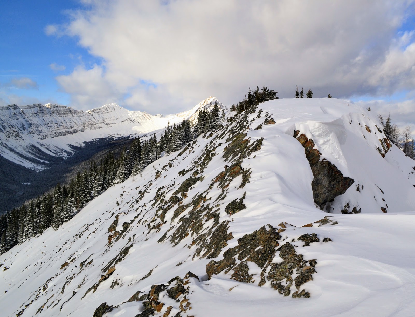
| Snow cornices require a high degree of care and alertness |
 |
| Panorama from true summit, looking north. Mt Lawson beyond. |
 |
| Summit cairn and Mt Lawson |
 |
| Looking south from summit |
 |
| Good place for a lunch break |
 |
| Saw this guy on my way down |
 |
| He was definitely curious about me, and let me get closer than I expected |
 |
| After letting me watch them for a while, this family decided to find a new grazing spot |
 |
| Back on the Penstock Loop trail. Mt Wintour beyond. |
 |
| Final stretch as daylight draws to a close. Highway 742 below. |


A very fitting way to unwind after the rigors of completing a Master's degree! I don't know how I've missed your blog before now, but I love everything about it--the trip log, photos, identification of salient features, topo map marking out the route you took--it's all great. I'll be following from now on.
ReplyDeleteThank you! I'm glad you enjoy the blog :)
ReplyDelete